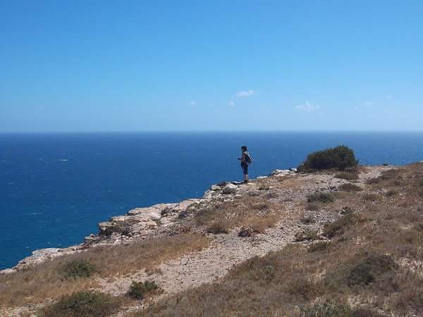
- Au programme, randonnée de Porto Farina (Ghar El Melh) passant par Sidi Ali El Mekki, Pour enfin atteindre la plage de Rafraf pour une baignade dans un coin paradisiaque.. Pour finir en beauté un café en groupe sur la plage.
Cap Farina est situé à une soixantaine de kilomètres au nord de Tunis et à une quarantaine de kilomètres à l'est de Bizerte. Rattachée au gouvernorat de Bizerte, la municipalité compte 5 018 habitants. Elle est chef-lieu d'une délégation de 18 525 habitants dont plus de la moitié réside en milieu rural. La délégation ne contient qu'une autre municipalité, Aousja, et deux conseils ruraux, Béjou et Zouaouine.
Le sommet du Djebel Nadour, d'une altitude de 334 mètres, (en faisant un détour par Raf Raf) et offre une superbe vue sur la région. Le djebel s'étire vers l'est pour former le cap Sidi Ali El Mekki (également appelé cap Farina ou promontoire d'Apollon), en face de l'île Plane, qui marque l'une des extrémités de la dorsale tunisienne.
Plus à l'est de la plage et sur le flanc sud du Djebel Edmina, on peut visiter le mausolée de Sidi Ali El Mekki qui est devenu un lieu de pèlerinage attirant les adeptes de diverses régions de Tunisie.
Plus loin encore et situé à hauteur du promontoire qui surplombe le cap Farina, on retrouve le mausolée de Sidi Haj M'Barek.
A travers pistes et sentiers, vous découvrirez des paysages fabuleux entre montagne, foret et méditerrané.
Difficulté : Moyenne
Durée : 5 heures
Distance : 12 KM
- In the program, hiking of Porto Farina (Ghar el Męlh) passing by Sidi Ali El Mekki, to finally reach the beach of Rafraf for a swim in a corner of paradise. To finish in beauty a coffee in a group on the beach.
Cape Farina is located approximately 60 kilometers north of Tunis and a 40 kilometers to the east of Bizerte. Attached to the governorate of Bizerte, the municipality has 5 018 inhabitants. It is the chief place of a delegation of 18 525 inhabitants, of whom more than half resides in rural areas. The Delegation only contains another municipality, Aousja, and two rural councils, Béjou and Zouaouine.
The Summit of the Jebel Nadour, from an altitude of 334 meters, (making a detour by Raf RAF) and offers a superb view on the region. The Djebel stretches out toward the east to form the cape Sidi Ali El Mekki (also called Cape Farina or promontory of Apollo), in front of the island plane, which marks one of the ends of the Tunisian backbone.
More to the east of the beach and on the southern flank of the Jebel Edmina, you can visit the mausoleum of Sidi Ali El Mekki who became a place of pilgrimage attracting the followers of various regions of Tunisia.
Even further and located at the height of the promontory overlooking the Cape Farina, we find the mausoleum of Sidi Haj M'Barek.
Through tracks and trails, you will discover fabulous landscapes between mountain, drill and Mediterranean.
Difficulty : Average
Duration: 5 hours
Distance: 12 km


Commentaires
Enregistrer un commentaire